April 12, 2022 1:15 pm
Uganda Electricity Distribution Company Limited (UEDCL) was formed in 2001 after Uganda divided the electricity sector into production, transmission, and distribution. UEDCL owns all of the country’s distribution assets and manages the contracts for private operators. It also operates a network serving nearly 100,000 customers. Finally, it is responsible for pole treatment for the entire distribution system.
UEDCL’s mission is to significantly improve operations for those that have access to electricity and provide access to those that do not currently have it.
Challenge
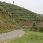
The Uganda electricity sector has been affected by many challenges, including the poor state of some assets, illegal connections, and rampant vandalism of equipment, that lead to equipment failure, low efficiency, and ultimately high losses, which negatively impact the sector’s financial position. A large segment of the population cannot pay its electric bill. Barely 50 percent of the population even has access to power.
As an asset owner, the company had historically looked to hard-copy records to provide an inventory and analysis of the condition and health of its assets. Staff later converted these hard-copy records to spreadsheets. However, the company recognized that the data was inaccurate and incomplete. There was no locational context. For example, the company did not have accurate enough information to locate switch points. As a result, UEDCL had to rely on field visits and the memories of experienced staff in regard to the asset.
The overarching mission of UEDCL was to increase access, but the company had little insight into where potential customers lived. Staff also could not verify what the future demand would be when potential customers were connected.
UEDCL lacked the tools necessary to meet its mission. Performing meaningful decision-making based on location-aware analytics was nearly impossible. Since UEDCL was also an operator for only a portion of the network, it could not integrate with real-time systems, such as SCADA.
Solution
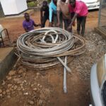
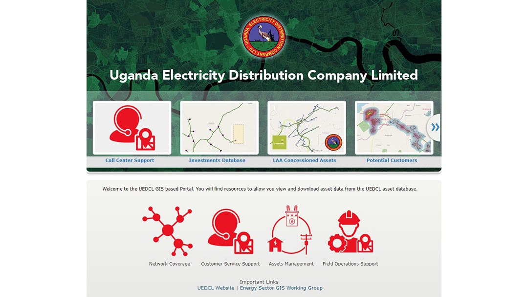
By 2016, UEDCL formed a geographic information system (GIS) team to address the data issues. It selected ArcGIS Enterprise as the company’s GIS software. The problems of using a manual data input process and spreadsheets—and the complete inability to see the situation on the ground—demanded a GIS migration. UEDCL promptly created an asset registry and mapped the portion of the network that the company operated. The team worked to migrate the data from the spreadsheets. But that was not enough. The team members needed to build a trustworthy GIS. They needed technology in the field to collect and verify the data. They began small with a few field devices but expanded with ArcGIS Field Maps.
“Among many strategies put in place by UEDCL to ensure hygiene on Umeme (the largest private operator) is the establishment of a concessioner network asset database through a geographical information system. To further ensure there is taxpayers’ value for money, UEDCL strictly continues to monitor the quality of works and materials executed and installed respectively in all the concession areas.”— Mwesigwa Paul, UEDCL Managing Director
Results
The real breakthrough occurred in 2018 when UEDCL installed a GIS based on ArcGIS Enterprise software, including a GIS portal. The portal created opportunities by allowing the company to develop and deploy web apps. UEDCL created many dashboards using ArcGIS Dashboards. This innovation gave employees of all levels visibility into operations, mobile work, and progress toward achieving the company’s mission to connect more customers.
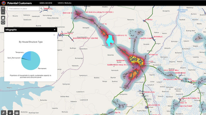
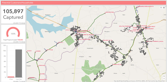
The GIS team used ArcGIS software’s spatial analysis capabilities to determine unconnected potential customers’ proximity to the distribution grid. This exercise created a list of potential customers that could easily be connected. UEDCL referred to these as low-hanging fruit opportunities. Using out-of-the-box analytics from ArcGIS, the GIS team members determined the potential demand. They used imagery to differentiate the brick-and-mortar buildings from the grass shacks. This analysis provided the basis for a very accurate future load forecast.
Partner
UEDCL developed the system with the help of the local Esri distributor, Esri Eastern Africa. The distributor provided consultation, configurations, and training during the data model development, data migration, and app rollout to the users. In addition, UEDCL—in collaboration with the electric utility stakeholders in Uganda—is a member of Energy Sector GIS Working Group Uganda, which is committed to addressing the issues the sector faces, heavily leveraging the capabilities of GIS.
Benefits
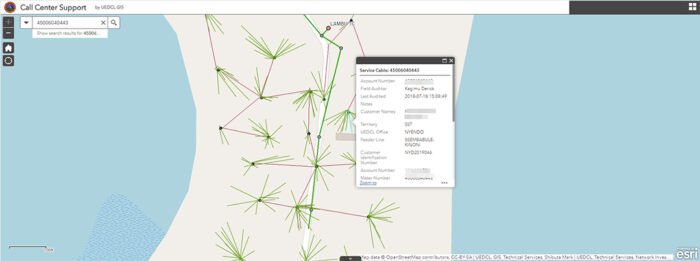
UEDCL now has a geospatial infrastructure in place. This framework enabled the company to accomplish three critical objectives to meet its mission. First, the framework better manages the growing records, not just for the assets the company owns and operates but also for all future asset additions. Second, the framework unifies information in the office with mobile staff, engineering, and decision-makers throughout the company. As a result, the time to move information has been reduced from days, weeks, or more to seconds. Third, the framework enables the company to perform analytics, giving staff insight to better plan for future network expansion. It also allows the company to hunt for and eliminate theft and vandalism and better understand existing and future customers. UEDCL call center staff can now interact with customers and have accurate knowledge of their locations, potential outage situations, and work progress.
Next Steps
UEDCL is committed to the integration of the operational systems to optimize workflows and resulting enterprise data with the aim of creating a single point of data analytics and visualization. Work has commenced integrating real-time operations, SCADA, and work management systems with the GIS.
UEDCL is currently seeking to better enhance the field operations with better devices to improve data capture capabilities of field staff during daily engineering operations.
Finally, UEDCL is looking to use its GIS to analyze new customer connections and the management of engineering, design, and construction so that the company can meet its long-term mission of providing affordable electricity to Uganda’s entire population.
“To be an outstanding asset owner, we had to have outstanding intelligence of the distribution network at any given time.”
—Mark Shibuta
GIS Team Lead, UEDCL
https://www.esri.com/en-us/lg/industry/electric-and-gas/stories/uedcl-case-study